Topography data is the backdrop for many of the most informative maps but it is not practical for all projects to include an elevation survey. Lucky for all of us there are numerous online sources of DEM elevation data. If the data is available from a WCS server, you can download it directly from within Surfer by following the instructions below.
How to download WCS grids in Surfer
- Click the Home | New Map command for the grid-based map type you wish to create (eg. Home | New Map | Contour).
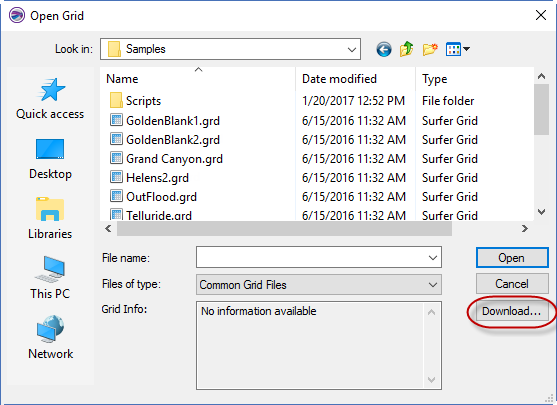
- In the Open Grid dialog, click the Download button to open the Download Online Grids dialog.
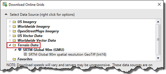
- Either select a layer from one of your predefined servers, or load a new WCS server using the instructions in this article: Add a WMS, OSM, WFS, or WCS server to Surfer.
- Choose the area to download from the Select Area to Download section.
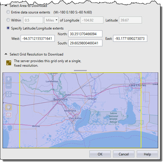
- If allowed, chose a resolution from the Select Grid Resolution to Download section.
- Click OK to download the grid and create the grid-based map.
Important Notes about downloading WCS grids in Surfer
- You can select an image from a WMS or OSM server, but it will not contain relevant z information, so it is not recommended.
- If you select a vector layer from a WFS server, you will see this message in the Select Grid Resolution to Download section:
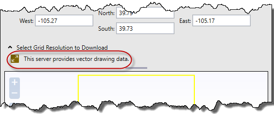
If you miss this message, when you click OK you will see this error: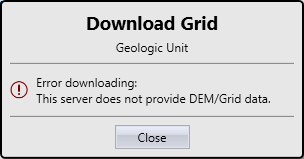
- If you clicked Home | New Map | Base, an error will be generated because you cannot use a grid file to create a base map. If you want to create a base map, use one of the servers that provide image or vector data (WMS, OSM, or WFS types) in the Download Online Maps dialog.
Updated May 2023
Comments
Hey there :) Thanks for the detailed tutorial on downloading DEM elevation data in Surfer. It's a lifesaver for those of us knee-deep in map-making. Your step-by-step guide is clear, but I stumbled upon a hiccup and thought I'd share my workaround.
When dealing with vector layers from a WFS server, I hit a snag and received an error. If you miss the warning message about the vector layer in the Select Grid Resolution to Download section, you'll face an "Oops, something went wrong" situation. Pro tip: Pay attention to that message!
To avoid any confusion, I'd suggest a friendly addition to your tutorial. Consider putting a highlighted note right before the 'Click OK to download' step, emphasizing the importance of checking for the vector layer warning. It might save some users from scratching their heads.
Thanks again for the awesome guide.
Please sign in to leave a comment.